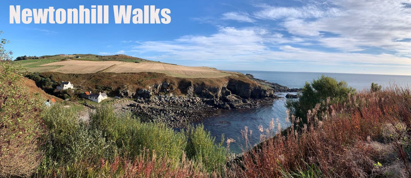
In Newtonhill we are blessed with amazing surroundings – and there is no better way to appreciate them than by taking a nice walk.
Here you will find a collection of routes that are popular with villagers and make the best of what the local area has to offer.
The six circuits are fun in themselves but can easily be joined together in many combinations to suit fitness levels or time constraints. Colour coded markers with an image of a sailing boat are being installed.
Be sure to refresh yourself afterwards at one of Newtonhill’s fantastic food and drink establishments.
A map showing all the routes together can be downloaded here. If you try the walks and have any suggestions or encounter any issues, please let us know via our contact form & we'll pass the information on to the group who helped produce the walk leaflet.
There is another popular walk nearby at Chapelton. Click here for details.
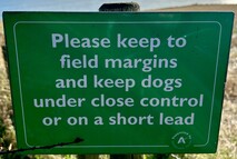
Before setting off please make sure that you have read and understood Scotland’s Access Code, especially how important it is to respect the crops of our local farmers as some of the routes involve walking around the edges of fields. Remember too that rural paths may on occasion become overgrown.
|
This project was made possible by Aberdeenshire Council's Phoenix Fund, which was designed to help the region’s town centres bounce back from the economic impact of repeated Covid lockdowns. It was was run by representatives from local businesses and community groups such as the NVA. The wider project included commissioning the Isabella model at the Braehead, production of the walk leaflet and installation of colour-coded way markers to mark the routes.
|
|
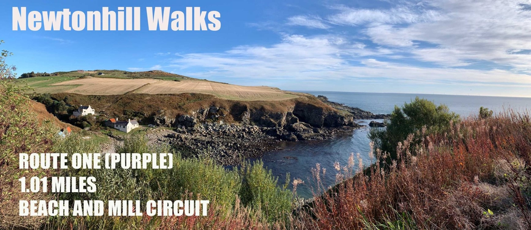
Route OneBeach and Mill Circuit
Purple waymarkers 1.01 miles What Three Words start point Google Maps Start Point Ordnance Survey route map |
|
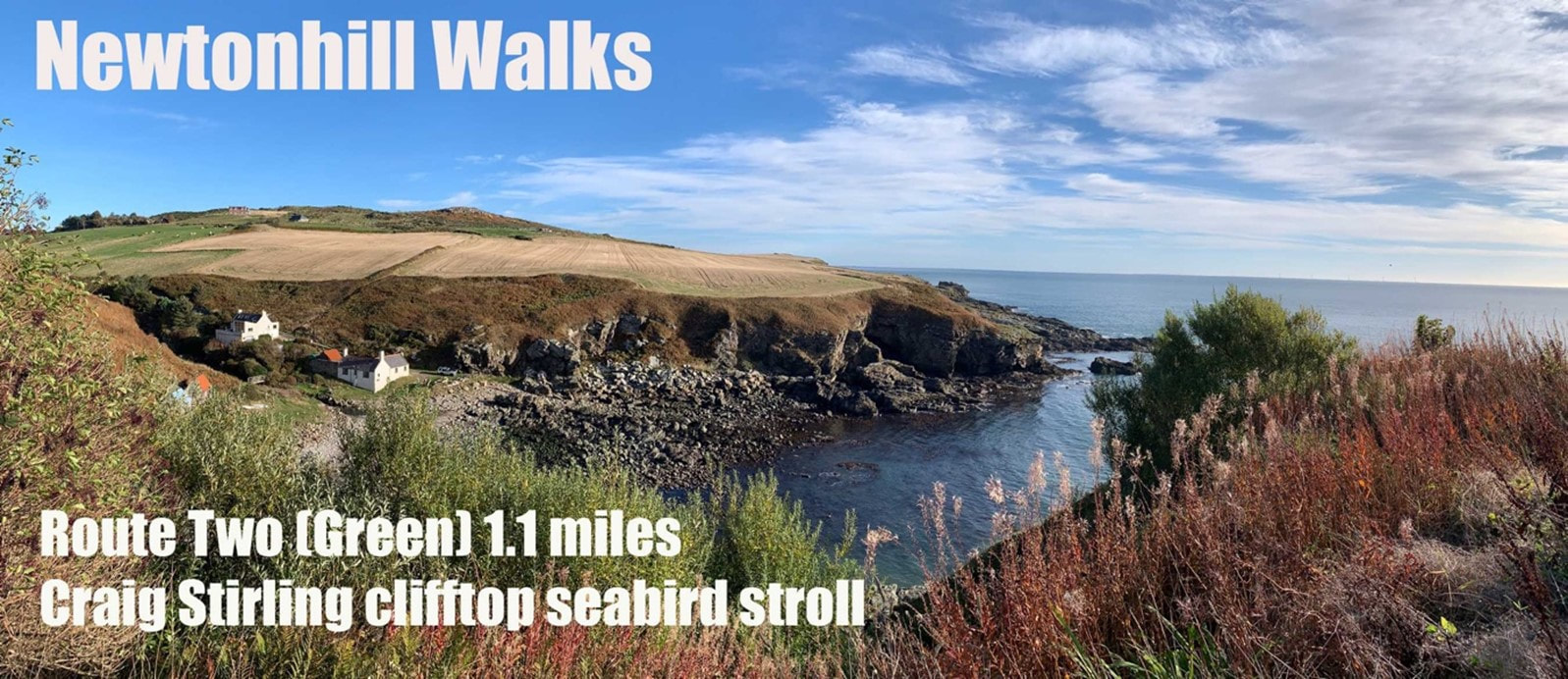
Route TwoCraig Stirling Clifftop Seabird Stroll
Green waymarkers 1.1 miles What Three Words start point Ordnance Survey map |
|
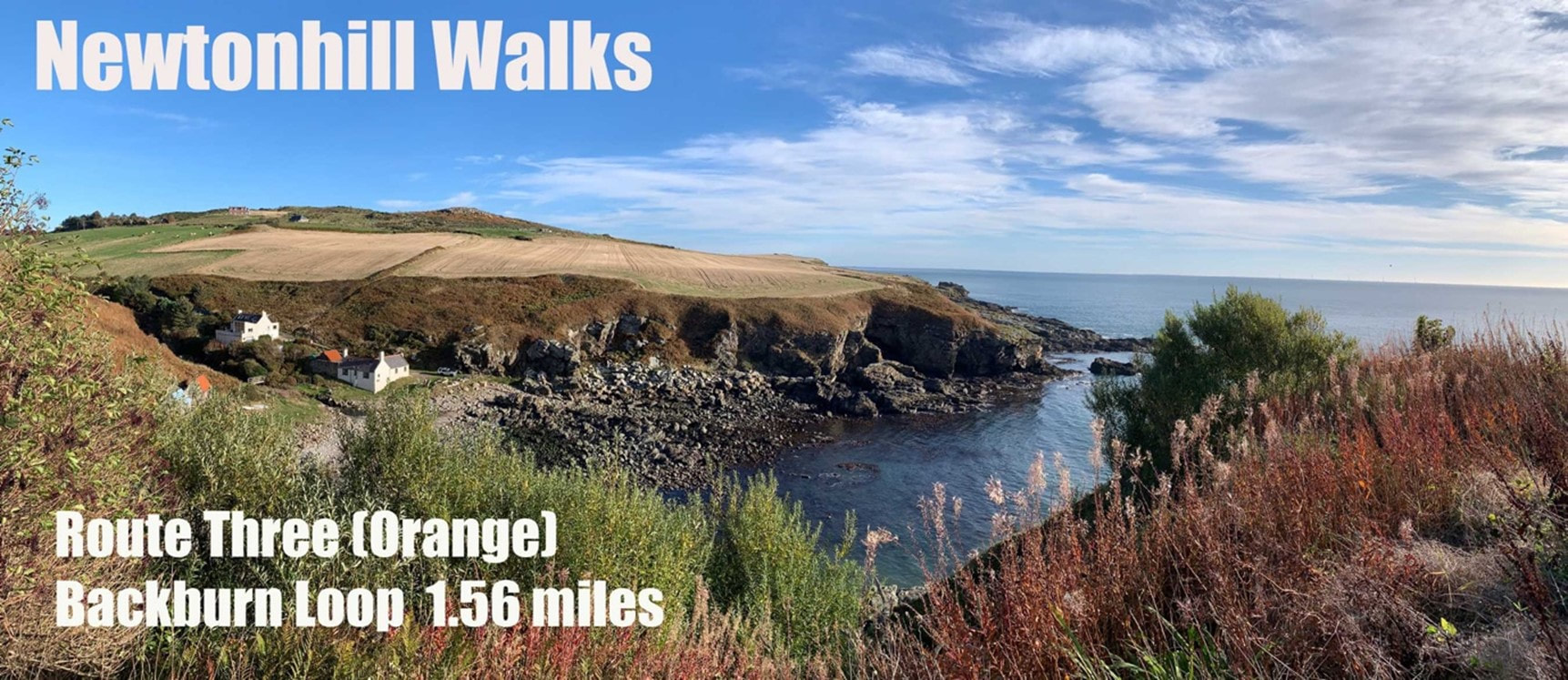
Route ThreeBackburn Loop
Orange waymarkers 1.56 miles What Three Words start point Google Maps start point Ordnance Survey route map |
|
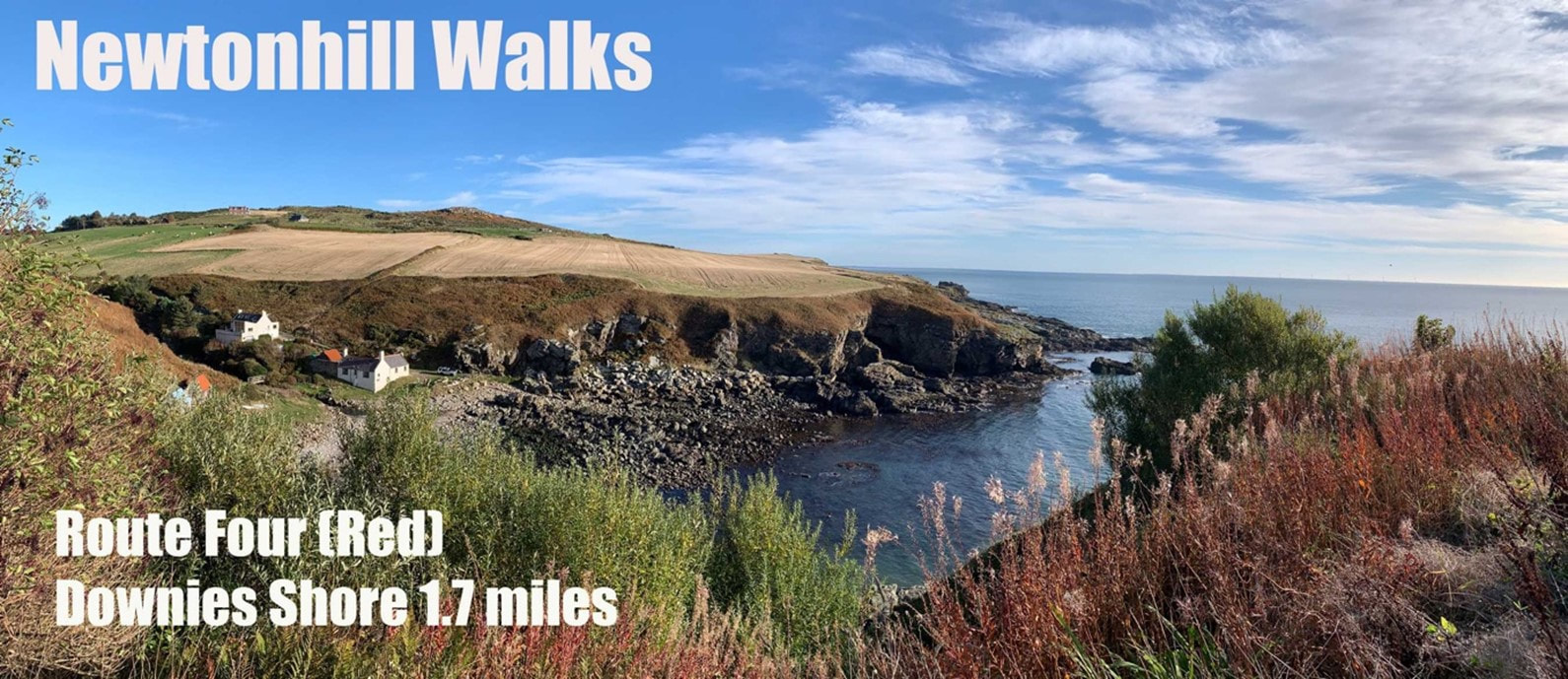
Route FourDownies Shore
Red waymarkers 1.7 miles What Three Words start point Google Maps Start Point Ordnance Survey route map |
|
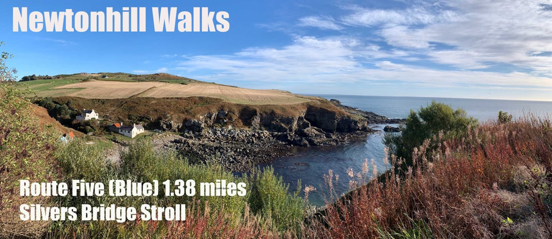
Route FiveSilvers Bridge Stroll
Blue waymarkers 1.38 miles What Three Words start point Google Maps Start Point Ordnance Survey route map (NB – OS map does not yet show the Barratt Homes- Whiteland Coast estate so that section is approximate) |
|
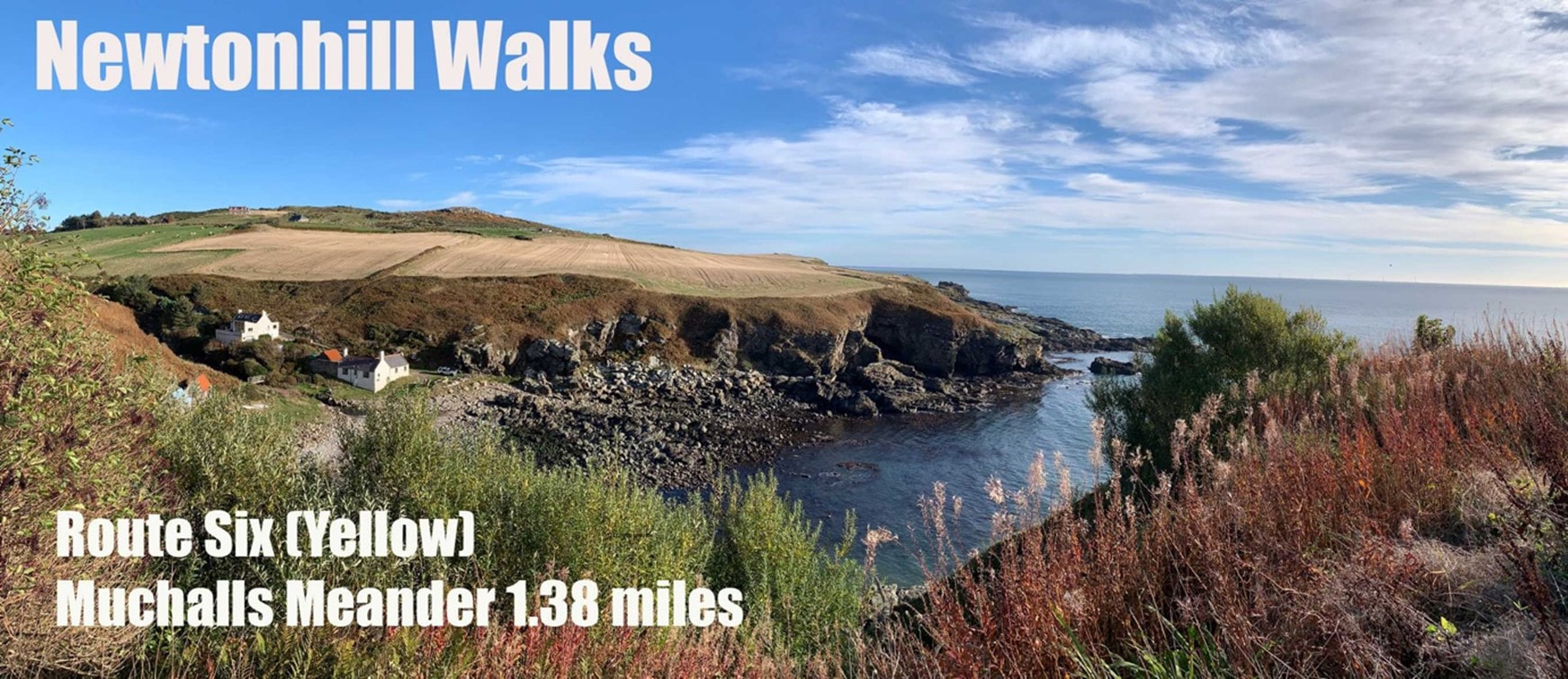
Route SixMuchalls Meander
Yellow waymarkers 1.38 miles What Three Words start point Google Maps Start Point Ordnance Survey route map |
